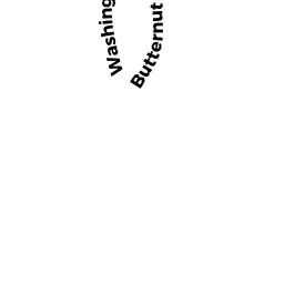
16 BUTTERNUT LN
Owner Information
GRACE FLOYD B TBYE & ELIZABETH
16 BUTTERNUT LN
GLOUCESTER, MA 01930 0000


Property Details
16 BUTTERNUT LN is classified as a Single Family Residential (Colonial).
The primary structure on this property was built in 1920. There are 3,002ft2 of built area within this property. There is 2,258ft2 of residential/living space within this property.
16 BUTTERNUT LN is valued at $515,900. The land is valued at $167,900 and the structures are valued at $346,000. There is an additional valuation of $2,000 on this property.
This property is in Zone R-20. Confirm with local Zoning Board authorities to ensure there are no overlays or other easements on this property.
The most recent deed for 16 BUTTERNUT LN is recorded at the local registrar in Book 663, Page 453. 16 BUTTERNUT LN was last sold on Saturday, September 1, 1979 for $1.
Assessment data from fiscal year 2022.
Flood Data
According to the FEMA National Flood Hazard Layer, this property does not appear to be in a flood zone. It may also be in an area not yet reviewed. Nonetheless, confirm this information prior to taking any action.
To view the flood hazards around this property, create a FEMA "Firmette" Map of the area around 16 BUTTERNUT LN.
Broadband Internet Providers
| Provider | Type | Bandwidth (mbps) | |
|---|---|---|---|
| VSAT Systems, LLC. | Satellite | 2 | 1 |
| GCI Communication Corp. | Satellite | 0 | 0 |
| Comcast | Cable | 1000 | 35 |
| Verizon New England Inc. | DSL | 1 | 0 |
| Viasat Inc | Satellite | 100 | 3 |
| HughesNet | Satellite | 25 | 3 |
Broadband service provider data from December 2020.
Adjacent Properties
- 6 BURNS WY
Single Family Residential owned by DIMOND MELISSA A & PUTNAM GRETCHEN J - 717 WASHINGTON ST
Single Family Residential owned by SHOUCAIR EDWARD & KAYE L - 18 BUTTERNUT LN
Accessory Land with Improvement owned by JOHNSON KAYE & SHOUCAIR EDWARD - 8 BITTERSWEET RD
Single Family Residential owned by CONDINO DAVID A & BRADY MARGARET M